
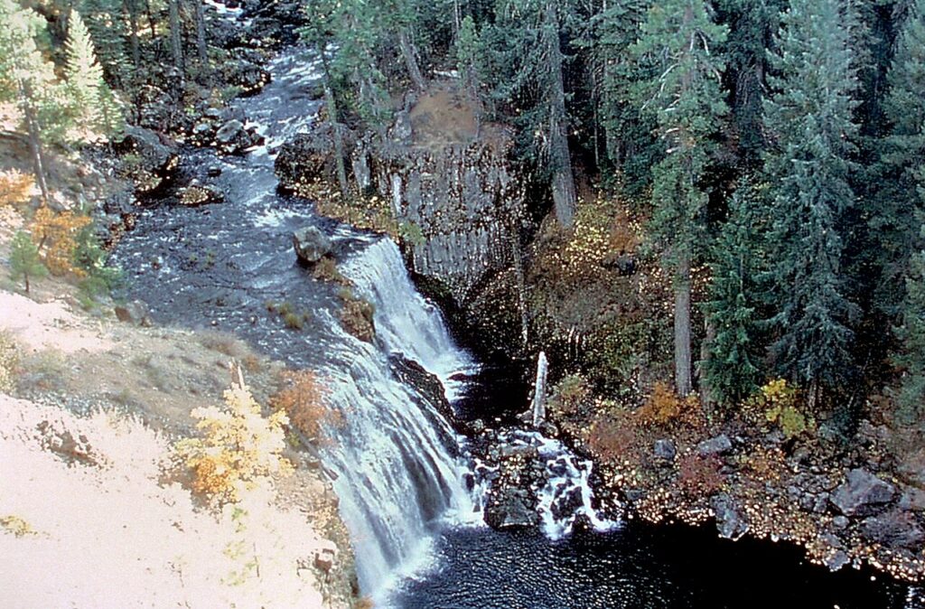
McCLOUD, Siskiyou County — The three waterfalls along the McCloud River attract visitors to the southern flank of Mount Shasta, but the surrounding trail is a working forest recreation area, not a paved attraction with guaranteed year-round access.
The U.S. Forest Service's McCloud River Trail guide describes an approximately 15-mile nonmotorized river trail extending from the Lower Falls area toward Algoma Campground. Visitors do not have to walk the entire route to see the lower, middle and upper falls, but the distances and grades vary by segment.
How to reach Lower Falls from McCloud
The Forest Service directs drivers southeast from McCloud along Highway 89 for roughly five miles, then toward the Fowler's Campground and Lower Falls area using signed forest roads. Its guide identifies the Lower Falls overlook as a practical trail starting point, with amenities such as picnic tables and restrooms described for the developed day-use area.
Those amenities may close seasonally or become unavailable during maintenance. Confirm access with the managing national forest before assuming that a specific road, restroom or water faucet is operating on the day you arrive.
What the hike involves
The agency describes the lower part of the trail as relatively easy, while noting that the stretch between Middle Falls and its upper overlook includes switchbacks, stairs and an uphill section. Visitors with mobility limitations or young children should choose their stopping point based on actual trail conditions, not photographs online.
Middle Falls is described as about 1.3 miles upstream from Lower Falls. Waterfalls and pools can look inviting, but the river may be extremely cold even on a warm afternoon, and rocks can be slippery. River flow, submerged objects and sudden depth changes create risks.
Important visitor precautions
- Use the Forest Service's official route description and current closures rather than drive into an unsigned side road.
- Check weather and potential wildfire restrictions before departure.
- Stay on designated routes, protect streamside vegetation and carry all trash out.
- Use caution near waterfall edges; do not equate a popular swimming location with supervised swimming.
- Respect fishing rules and obtain required California fishing licenses where applicable.
The guide is useful to McCloud residents and businesses answering tourist questions, but it is not a live trail-condition report. Seasonal snow, falling trees and road work can change access. Check the Shasta-Trinity National Forest before traveling.
Sources: U.S. Forest Service McCloud River Trail guide and Shasta-Trinity National Forest recreation information.
Support McCloud News
Choose how to support McCloud News:
Credit / Debit Card via StripeChoose your contribution amount on the secure California58 Stripe checkout. One-time support for independent local journalism.
Continue with PayPal Continue with ZelleZelle payments go to Vitaly Ataev Troshin. Please verify the recipient in your bank before sending. Availability depends on your bank.
Optional reader support. When possible, add “McCloud News” to the payment note. Contributions are not advertised as tax-deductible. Support does not influence editorial decisions.More from McCloud News
- November Camping Near McCloud: Some Forest Sites End Their Primary Season October 31 →
- Camping Near McCloud: Forest Service Lists 14-Day Limits and River Loop Restrictions →
- McCloud River Trail Runs About 15 Miles From Lower Falls Toward Algoma Campground →
- McCloud Library Opens Monday, Wednesday and Friday From Noon to 4 p.m. →
СООБЩЕСТВО
Комментарии
Присоединяйтесь к обсуждению California58. Чтобы комментировать, необходимо войти в аккаунт.
Создайте бесплатный аккаунт California58 или войдите через доступную социальную сеть.